
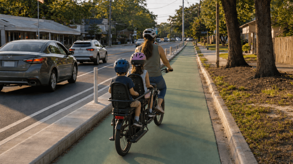
A mother carries two helmeted children on a cargo bike in a protected bicycle lane separated from automobile traffic. (Conceptual image generated with AI)
Georgia invests billions of dollars each year constructing, maintaining, and supporting its road network.
Are we getting the same return on investment this century as we did in the last?
Expanding road networks over the last 100 years created enormous economic value. Roads connected communities, supported industry, opened land for development, and helped people reach jobs, schools, churches, stores, and services.
But transportation evolves.
Across the country and around the world, communities are experiencing rapid growth in micromobility. The term includes relatively small, low-speed vehicles such as conventional bicycles, electric bicycles, scooters, and other devices designed primarily for short trips. Some are used for recreation, but they increasingly provide a practical and healthy way to reach everyday destinations:
https://www.npr.org/2025/10/18/nx-s1-5532087/why-some-parents-are-ditching-minivans-for-cargo-bikes
That does not mean every electric device marketed as an “e-bike” belongs on a bicycle path. High-powered electric motorcycles capable of traveling well beyond normal bicycle speeds present a different set of safety and regulatory questions. But legitimate low-speed micromobility is growing, and infrastructure designed only for full-sized motor vehicles leaves these users with few safe places to travel.
The micromobility revolution has not yet reached Warner Robins at the scale seen in many other communities. That does not mean it will not arrive. E-bikes are becoming more practical, capable, and affordable. Cities across Georgia and the country are already confronting questions about where these devices belong and how they can be used safely.
Warner Robins has an opportunity to consider the infrastructure side of that issue before it becomes a local problem. More importantly, we have an opportunity to create healthy choices for short trips, improve public safety, and get more value from streets we have already paid to build.
That brings us to Corder Road.
Warner Robins is preparing to repave approximately 2.26 miles of Corder Road between Watson Boulevard and Russell Parkway. The Corder Road portion of the project is estimated to cost $901,084. The work includes patching, milling, resurfacing and replacing pavement markings. The project documents direct the contractor to “Restripe roadway to match existing markings.”
City Council has already approved the resurfacing contract, so the window for reconsideration is narrow. But approving the contract does not necessarily place the striping plan beyond reconsideration. The contract may be modified by mutual written consent and requires the work to be completed by November 30, 2026. Any alternative would require prompt professional review, city authorization, and coordination with the contractor and GDOT, which are hurdles but not insurmountable.
The relevant question is not whether the original vote can be undone, but whether the striping plan can still be reconsidered before the new markings are placed. Repaving is maintenance. Restriping is design!
Fresh pavement presents a rare opportunity to reconsider how the publicly owned space between the curbs is allocated. Painting the same lines back in the same places is a design decision. It chooses the existing model without first asking whether it continues to provide the best return for Warner Robins.
A Connection, Not Just a Bike Lane
Corder Road is not merely a route between Watson Boulevard and Russell Parkway. It could become an important part of a larger transportation network.
The city is moving forward with a reconfiguration of Green Street, which will add a protected active transportation route from Houston Road almost to Robins Air Force Base. That is a significant step, and the city deserves credit for moving it forward. It will become Warner Robins’ first protected active transportation route, a genuine milestone for the city.
What a combined Green St, Corder Rd, and Wellston Trail network might look like.
But having a bicycle lane somewhere is not the same thing as having a useful transportation network.
One protected route is no more a transportation network than one well-paved block is a road system. People will use bicycles, e-bikes and other low-speed devices for practical trips only when they can travel safely from where they are to where they need to go.
A route that ends at a high-speed corridor, a difficult intersection or a disconnected neighborhood may serve confident riders, but will not be comfortable for a child, an older adult, or someone making an ordinary trip to work or the store.
A safe-for-all-ages network does not require a protected lane on every street. Quiet residential streets can provide many of the connections. Larger corridors matter because they cross barriers, connect neighborhoods, and provide access to destinations.
Green Street can become one part of that system; Corder Road another.
Together with planned improvements on North Houston Road and North Davis Drive, Corder Road could help connect neighborhoods, churches, businesses, schools, Wellston Trail and potential extensions, Commercial Circle, and Robins Air Force Base. The network could eventually continue along South Corder Road, where much new development has already started, and a traffic study is already in progress; South Corder Road’s current striping layout should also be considered, at some future date.
The current study, however, should not only consider how many additional automobiles might be moved through the corridor. It should also ask how adults and children in these new developments will reach nearby schools, churches, businesses, parks, and neighborhoods without being required to make every trip by car.
The city does not need to build this entire network at once. It does need to recognize the network before resurfacing projects lock its individual pieces back into their previous configurations for another decade or more. It should take advantage of the opportunities it has, not the ones it wishes it had.
Connecting Operation Reawaken
This opportunity is especially relevant as Warner Robins moves forward with Operation Reawaken.
The city is investing in Commercial Circle not simply to improve a few buildings, but to create something Warner Robins has never really had: a recognizable downtown center where people can live, work, gather, and support local businesses.
That is a worthwhile goal. But placemaking does not end at the boundary of a redevelopment site. A successful place must be connected to the neighborhoods around it.
If Commercial Circle becomes a walkable district that can be reached only by automobile, Warner Robins will have created a walkable island. Visitors may be able to walk once they arrive, but nearly everyone will still need to drive there and find somewhere to park. In that respect, it will function more like a conventional shopping center than a genuinely connected downtown.
Corder Road reaches Watson Boulevard near the Operation Reawaken area and extends south through established neighborhoods and commercial areas to Russell Parkway. It offers more than a possible location for an isolated bicycle lane. It offers a potential spine connecting one of the city’s largest redevelopment investments to the people and neighborhoods around it.
Transportation and placemaking cannot be treated as separate projects. Streets determine whether people can reach a place, whether nearby businesses benefit from it, and whether public investment produces activity beyond the boundaries of the redevelopment itself, as well as whether a place is pleasant to be in or not.
A Question Worth Asking
This is not an argument for rebuilding Corder Road from the ground up. It does not begin with purchasing additional right of way or launching another expensive construction project.
The city already owns the pavement. Corder Road is already being resurfaced. New markings are already included in the contract.
Measurements taken at several points suggest that Corder Road is approximately 38 feet wide from curb to curb, currently divided into two 12-foot travel lanes, and a 14-foot continuous center turn lane. Traffic counts between Russell Parkway and Watson Boulevard range from approximately 10,700 to 12,300 vehicles per day.
Corder Road is posted at 35 mph, but its wide, open configuration can invite faster driving. Reallocating the roadway could do more than create space for active transportation. Design choices can help make 35 mph feel natural, managing speeds continuously rather than relying solely on signs or occasional enforcement.
The WRATS 2050 Metropolitan Transportation Plan does not identify Corder Road as part of the national, statewide, or STRAHNET freight networks. Its 2023 truck-traffic map places the corridor in the lowest category, at 0–100 trucks per day.
Those facts do not establish what a final design could be, but they do establish a legitimate question worth asking:
Could the existing width be allocated differently while preserving two-way automobile travel and creating an all-ages active transportation connection?
Answering that question requires more than dividing 38 feet on paper. Actual speeds, traffic volumes, turning movements, driveways, intersections, drainage, emergency access, and the form of physical protection would all require professional review.
But requiring professional review is not a reason to automatically reproduce the existing design. Georgia has engineering and planning firms that specialize in creating active transportation facilities, complete streets, and designing constrained corridors. Toole Design, for example, has an established presence in Atlanta, and other qualified firms have experience developing protected bicycle facilities and integrating them into existing transportation systems, even when tested with inexpensive tactical materials.
The city does not need to accept a design developed from online measurements. It should ask qualified professionals what is possible before the existing markings are restored.
That review must also be permitted to examine the assumptions behind the current configuration. If the existing lane widths, continuous center turn lane, and every element of the corridor’s current complexity are treated as nonnegotiable, the outcome will have been decided before a review begins. A thoughtful redesign could preserve efficient two-way automobile travel while making the posted speed more naturally self-enforcing.
Protected facilities have already been incorporated into existing Georgia corridors, including portions of Memorial Drive in Atlanta, a state route and GDOT-led project. Corder Road does not need to copy Memorial Drive or any other corridor. The example simply demonstrates that reallocating existing roadway space to accommodate protected active transportation is not an idea foreign to Georgia transportation engineering, even though it is new for Warner Robins.
If a practical concept is identified, incorporating it into a resurfacing project may cost far less than returning years later to retrofit the corridor as a separate project. Even if some protection or intersection work must be phased in later, decisions made today can preserve rather than foreclose that opportunity.
This is a fiscally conservative approach to infrastructure. It asks the city to maintain what it owns, examine whether existing public space can be used more efficiently, coordinate related projects, and obtain the greatest practical return from money already being spent.
Fiscal responsibility is not simply spending less today. It is making today’s expenditures produce as much long-term public value as reasonably possible.
A Decision About Warner Robins’ Future
For decades, Warner Robins designed its transportation system almost entirely around moving automobiles. That system supported the city’s growth, but continuing to reproduce it without reconsideration will not necessarily provide the same return in the decades ahead.
The question is not whether cars will remain important. They will. The question is whether every short trip must continue to require one.
A connected, safe-for-all-ages network would give residents another practical option. It could help young people reach school or work, allow families to make nearby trips together, provide mobility to people who cannot drive, and make healthy choices for short trips more realistic.
It would also give the Mayor’s Health Initiative a lasting infrastructure component. Programs can encourage healthier behavior, but safe streets make healthy choices practical. That could produce benefits for today’s residents, their children, and their grandchildren… a legacy our current elected officials likely want to leave.
A connected network would also help people reach Operation Reawaken and other public investments without requiring an automobile and parking space for every visitor.
Corder Road will soon receive new pavement and new markings. Once those markings are restored, this opportunity may be postponed until the next major project, perhaps a decade or more from now.
Before that happens, Warner Robins should, at the very least, pick up the phone and make some calls!
Ideally, they should commission a professional evaluation of alternative configurations, consider Corder Road’s relationship with the emerging Green Street network and Operation Reawaken to determine whether the existing public space can serve the community more effectively.
The pavement is already there. The width is already there. The city is already paying to place new markings.
We don’t know what it could look like. But we know enough to ask questions before we paint ourselves into a corner with the limitations of the current model.


Leave a Reply